


 Download(28.09MB)
 1.2.0.13
 12.03MB
7.3
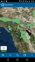
Accurate Data Collection Made Easy
Use maps anywhere to ground truth your data, make observations, and respond to events. You'll improve the efficiency of your field workforce and the accuracy of your GIS.
Features:
- Collect and update data using the map or GPS
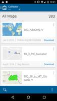
- Download maps to your device and work offline
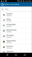
- Collect points, lines, areas, and related data
- Fill out easy-to-use, map-driven forms
- Attach photos to your features
- Use professional-grade GPS receivers
- Search for places and features
- Track and report where you've been
- Integrate with Navigator for ArcGIS
- Integrate with Workforce for ArcGIS
 Similarity
January 22, 2026
January 22, 2026
January 21, 2026
January 20, 2026
January 18, 2026
January 18, 2026
January 17, 2026
January 16, 2026
January 15, 2026
January 15, 2026
January 13, 2026
January 12, 2026